
Mapping with advanced technology
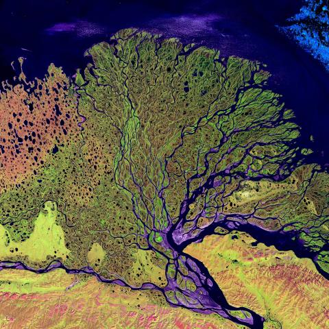
Through GIS and Remote Sensing we are able to explore the planet's scientific processes and physical structures, and study our impact on the world.
The specialist equipment and software we have access to enables us to collect data from most types of photography, imagery or documentary sources using aerial and satellite remote sensing and geographic information systems (GIS). We have a range of survey equipment, from basic total stations to scanning multi-stations and survey-grade GNSS (GPS) receivers. We also have a range of Uncrewed Aerial Systems that allow us to capture imagery, multi-spectral and thermal data. Drone data is used to evaluate glaciers, coastal flooding, seagrass, saltmarsh and land use change.
Students use the resources on courses including BSc (Hons) Geography and MSc Geographical Information Systems.
Explore our GIS and Remote Sensing facilities
Equipment and amenities
- Photogrammetric software to support advanced levels of digital remote sensing
- Industry standard GIS software and enterprise database software to support the full spectrum of spatial analysis
- Total stations
- Multi-station
- Survey-grade GNSS (GPS)
- Fixed-wing UAS
- Multi-rotor UAS
- RGB, multi-spectral and thermal sensors for UAS
Related facilities
Physical Geography and Meteorology Laboratories
Use the latest physical and meteorological equipment in our labs, including a rainfall simulator and automatic weather stations.

Biophysical laboratories
Use professional-standard equipment to explore how the structures and functions of molecules change under different conditions.

Electron Microscopy and Microanalysis Unit
Gain expertise in high-magnification imaging and analysis of the chemical and physical structure of natural and manufactured materials.


